Indentifying and Protecting Wildlife Corridors

Archive for the ‘animal pathways’ Category

Link

Video: animals of Sandia Mountain

Here is a new video we’re making available via YouTube to show some of wildlife that need to move to and from Sandia Moutain.

https://www.youtube.com/watch?v=8KGKrCqWP34

Help protect this area as a wildlife corridor, its already there!

Send your comments before April 16th to: wildlife.corridors@state.nm.us to inform the Wildlife Corridors Act, which is seeking public comments for a State wildlife corridor action plan.

Protect the Crest of Montezuma wildlife corridor!

The light green shaded area is the safest path for wildlife to and from Sandia Mtn.

Lets Protect the Crest of Montezuma!

From: Pathways: Wildlife Corridors of NM, an all volunteer, non-profit organization.

Pathways vision is to see the mountains of New Mexico connected with protected
passage for wildlife of all kinds.

Sandia Mountain is ringed with development – the city of Albuquerque, freeways and subdivisions. There is only one narrow opening to and from the remaining mountain at the North East corner between Placitas and La Madera. Without roads and official trails, this rugged area is designated non-motorized travel within the Forest Service portion. On the Crest of Montezuma, managed by the Bureau of Land Management, official trails and uses of all sorts are being proposed. These uses are not a problem with official oversight, but these Federal agencies do not have funding for law enforcement personnel. Without a ranger at the trail head and on the trails we will see the spider webbing of trails, target shooting and trash – plus the increased access for illegal trapping and poaching of wildlife.

Won’t you help protect Sandia Mountain and keep it connected to the other mountains of New Mexico for the safe passage of wildlife? Let officials know that you want this area, the last of its kind, protected from illegal activity and the current laws enforced. Thank you for caring about the life of your mountain! share the link here: Crest of Montezuma

The light green shaded area is the safest path for wildlife to and from Sandia Mtn.

Bear food survey 2017

Pathways Mast Surveys Summary 2017

This year Pathways volunteers conducted 8 mast surveys between May 6th and Sept. 23rd, 2017. We surveyed areas mainly on the north end of Sandia Mt. in cooperation with the Sandia Mt. Bear Collaborative, who were conducting mast survey across the rest of Sandia Mountain. Pathways mast survey volunteers included team leaders Peter Callen and Stephanie Long and survey team members Ross Phillips, Mark Bundy, Cameron Weber, Ian Daitz, Elaine Sullivan, Renee Robillard, Jean Roberts, Michael Scialdone, and Cathy Langfelt.
This year we included gathering bear scat for a dietary analysis, but no bear scat was found by our Pathways teams.

The main mast species of Piñon Pine, One-Seed Juniper, and Gambel’s Oak had Juniper berries as the most successful crop this year, with moderate to poor acorn production, and a mast failure of Piñon nuts. These surveys covered the north end of Sandia Mt. from the Piedra Lisa trail to Del Agua Cyn., the Agua Sarca trail from Tunnel Sprgs. up to 7,800’ elevation, Las Huertas Cyn. from Placitas up to the U.S.F.S. picnic area, Palomas Peak trail, Faulty trail from the Sandia Man Cave up 3 miles, and several areas off of Hwy. 165 at higher elevations including Media Cyn., Balsam Glade, and then up the Crest highway to Ellis trail at 10,000’+ elevation.
Dozens of miles of trails were walked while we observed trees and plants along the trails, as well as surveying piñon cone and juniper berry production from a distance with binoculars. Hundreds to thousands of trees and other plants would be closely observed on each of the surveys.

Gamble’s Oak had poor to moderate acorn production, the best areas being near Las Huertas Creek and springs along the Piedra Lisa trail. Wavy leaf oaks had moderate production in the lower elevations (~6,000’+) of Piedra Lisa trail and Las Huertas Cyn.
Piñon Pine trees did not produce new cones this year, and the small cones for next year mostly dried up and died in the hot, dry months of June and July. August was our only real month of moisture and cooler temps., and that helped the One-Seed Juniper production. The Juniper berries started out abundant again this year, especially at the lower (~6,000’) elev., but the summer drought kept them small and thinned out overall production from abundant down to moderate. The rains of August helped plump up and save the Juniper berry crop. September was unusually dry for almost the whole month, but then the last 4 days brought heavy rain. By this time of the year though it was almost too late to actually have an effect other than prolong what was left of the harvest and bring back a little green up of the mature grasses and forbs.

Other soft mast species had very mixed results, with fairly poor to moderate Chokecherry and Oregon Grape production; moderate and fairly good bear corn production; a moderate to good grass and forb production at higher elev. (7,500’ +); and abundant Prickly Pear Cactus production at lower elev. (~6,000’). Banana Yucca was poor however, as were the Currants, Gooseberries and Snowberries. Lower elev. fruit orchards had mixed success as well, with some areas having poor apple and peach production, while other areas had a moderate fruit crop.

So overall it wasn’t a great year for bear foods on Sandia Mt., and bears did come down into the human habitation zone starting in August and continued to raid bird feeders, trash cans and fruit orchards throughout September. The Juniper berry and Cactus fruit were the most abundant mast, with some patches of moderate acorn and bear corn production. Grass and forb production was good at higher elevations, but Fir tree mortality was high in Las Huertas Cyn. and some eastern side canyons. A huge explosion of Tussock Moth caterpillars were everywhere on the dying Fir trees from July into September.

New Video Shows Wild Jaguar in Arizona

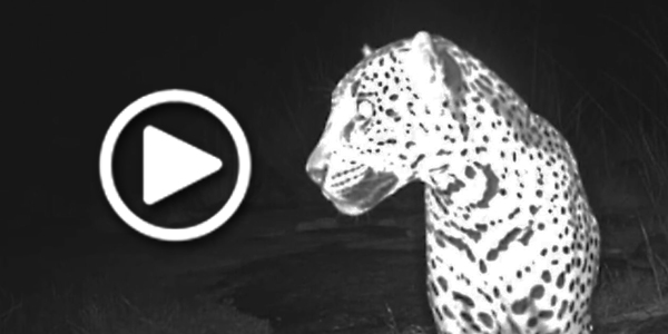
The Center for Biological Diversity released new video today of a wild jaguar currently living in the United States, named ‘Sombra’ by students of the Paolo Freire Freedom School in Tucson. Captured on remote sensor cameras in the Chiricahua Mountains of southern Arizona, the footage shows what appears to be the same jaguar photographed in the nearby Dos Cabezas Mountains in November 2016.

“This beautiful cat has now appeared in images taken seven months apart,” said Randy Serraglio, conservation advocate with the Center. “It seems that it’s established residence in excellent habitat more than 50 miles north of the border, which is great news for jaguar recovery.”

“Our kids benefit from an educational philosophy that connects them to their world in a concrete and hands-on way,” said Tadeo Pfister, a science teacher at Paulo Freire. “They love studying these big cats, and it’s thrilling to know that they’re helping to shape a future that includes jaguars.”

The footage, shot this summer, is the first publicly released video of this jaguar. Individual jaguars’ spot patterns are unique, and biologists have compared the photographic evidence to determine that this is the same cat that was photographed last year by a camera maintained by the Bureau of Land Management.

In response to the Center’s video release, Arizona Game and Fish Department officials confirmed that Sombra is a male, based on previously unreleased photographic evidence.

Jaguars continue to move into Arizona from a small, vulnerable population in northern Mexico. Seven jaguars have been confirmed by photographs in the United States in the past 20 years, including most recently:

The jaguar named “El Jefe” by Tucson middle school students was photographed by trail cameras more than 100 times in the Santa Rita Mountains near Tucson between 2012 and 2015. Video footage of El Jefe released in February 2016 went viral and was seen by millions of people around the globe.
A male jaguar, named “Yo’ko” by students at Hiaki High School on the Pascua Yaqui reservation, has been photographed repeatedly between December 2016 and May 2017 by trail cameras in the Huachuca Mountains in southern Arizona. Yo’ko appears to have established a territory on the Fort Huachuca military reservation.
“Sombra,” which is Spanish for “shadow,” is the third U.S. jaguar detected in the past three years, originally photographed in November 2016 in the Dos Cabezas Mountains just north of the Chiricahuas.

click the link below to read the rest of the story and see video options:

Source: New Video Shows Wild Jaguar in Arizona

Bridge just for wildlife opens near Tucson

A new overpass, and an associated underpass, just for wildlife, has opened north of Tucson, AZ.  

Source: $9.5 million bridge just for wildlife opens near Tucson

Volunteers lay foundation for habitat restoration 

Like the ABQ Wildlife Federation here in New Mexico, these volunteer groups in Arizona are using rocks to build well designed structures, slowing down water run-off and preventing soil erosion, which in turn builds up soil and supports vegetation for wildlife.

Early last Saturday under already sweltering conditions, a half-dozen men and women heaved bread loaf-sized rocks into a large drainage on the outskirts of the Patagonia Mountains to create a “Zuni bowl”, a rock structure designed to prevent soil erosion.

Read the full article here:

Source: Volunteers lay foundation for habitat restoration | Local News Stories | nogalesinternational.com

US wildlife needs corridors to escape heat – Climate News Network

19 June, 2016 – Rising temperatures will force wild creatures to seek cooler refuges – but safe routes for them to migrate may be scarce, scientists say.

Kind of stating the obvious, but even with “41%” connectivity rating in the west, that is still under half of the land that has reasonable connected pathways for wildlife throughout the western U.S. Not enough when you really see how loss of habitat connectivity impacts most “walking, sliding or crawling” species, and even the ones that can fly, as they need habitat connectivity too. When flights become too long or too stressful, even the birds can and have been impacted by climate change and habitat loss.

Read the article here:

Source: US wildlife needs corridors to escape heat – Climate News NetworkClimate News Network

Wildlife “Track and Sign Identification” course with Casey McFarland

We organized another wildlife track and sign identification course with renown wildlife specialist Casey McFarland on April 9th and 10th.  He will be in the area this summer and would like to do more courses, so get on our wait list and I’ll keep you posted.

Here is some feedback from a couple of the latest participants:

From Michael Cox ~ The weekend was terrific!  Casey taught me a new way of looking at the natural world.  It was like suddenly realizing that you’ve been living in the dark and having the light turned on.  It was intimidating and challenging but I’d do it again next weekend if I could, and I hope that Casey does another session sometime soon.

I am interested in your project, but I should tel you that I only received a 68 in the course, and reached some astoundingly stupid conclusions, so I’m not sure how much help I could be. So please alert me when you go out next time.

PS- Thanks for the heads up on the course, I wouldn’t have missed it for the world.

and from Sarah and Matt Fontaine ~Hi Peter,

Matt and I both thoroughly enjoyed the weekend, and got so much out of it!  I have been looking at tracks, and books of tracks, for a while… it was so satisfying to have someone with extensive knowledge to give hard facts to what had previously been questionable deduction.  And Casey showed us animal sign that I would have walked right past, not knowing what to look for.  We also appreciate the style of teaching: having us try to figure out what a track/sign is using whatever knowledge and common sense we have, before just telling us.  That really gets one looking around, analyzing the surroundings, asking questions like ‘who would live here?’ or ‘what size animal would make that scat?’

We are interested in volunteering for the Pathways monitoring program, do keep us posted!

Voter-approved wildlife crossing

wildlife overpass

Here is an example of what can happen when people put their money where their mouth is.  If AZ can do it, NM can do it!

Voter-approved wildlife crossing part of Oracle Road widening.

People gotta drive, animals gotta move! But road-kill, no gotta happen.

For Mule Deer, an Incredible Journey – NYTimes.com

Deer release

One of the priority wildlife passages in the Rocky Mts. is highlighted here in this NY Times piece:

For Mule Deer, an Incredible Journey – NYTimes.com.